
|
Distance |
24.9 km / 15.4 miles |
|||
|
Explorer maps |
260 Nottingham - Vale of Belvoir , 247 Grantham - Bottesford & Colsterworth |
|||
|
Time |
6 - 6.5 hours average time based on Naismith’s rule |
|||
| Total ascent | 313m | |||
| Total descent | 343m | |||
|
Waypoint coordinates |
|
|||
| Download PDF |
|
|
||
|
Overview |
The route follows well marked and pleasant paths to end the day on the Jubilee Way. |
|||
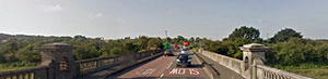 1 - At Gunthorpe Bridge cross the river and take road left to East Bridgeford. Take the 3rd footpath right across fields and then up the steps avoiding the road. Turn right at Kneeton Road and up Kirkhill, then take the footpath left opposite the old coach house and continue to pass the back of the houses to reach Springdale Lane. At the corner take the footpath right (sign on a lamp post) that will cross fields to the A46. Turn right and cross over by the bridge. Take Chapel lane (Bingham) off the roundabout and then the footpath left into fields. This will become a track, before the industrial buildings take the footpath right over the stream, across the field to Butt Playing Field. Cross the railway line and into the market square.
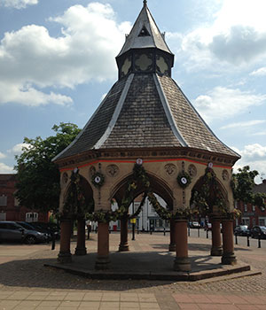 2 - Turn left in the square, towards the church and right along Cherry Street and across the road to the Byway. Turn right and left public footpath passing to the left of the leisure centre and right round the building to walk past flood-light pitches on the left and the athletics track. The footpath is in the left corner of the field. Turn left to follow the path along the top of the athletic track. This will bring you onto the A52. Cross over (careful this is a busy road), across the field, and take the path right down the side of the railway bridge to join the old railway line.
3 - Follow the line until just before the railway crosses the River Smite. Turn left into the field and cross the river using the footbridge. Ignore the path left but continue through fields almost parallel with the railway line to a path t-junction. Turn left and just before Granby Lane take the footpath right along the River Wipling and the path to Granby which crosses over the road to Hall Farm. The path runs to the right of the farm track to the right corner of a farm building. Around the buildings it was overgrown and hard to travel through, there was also a bull in the field after skirt-ing left round the last building. Travel through the gate ahead and then right to reach the village green, then right towards Plungar.
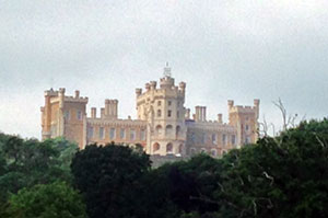 4 - After leaving the village take the footpath left after the bridge and the 2nd crossing over the stream to eventually reach a track and then turn left along the permissive route. After crossing the disused Grantham Canal, half way up the hill take footpath left and then left again at the road into the village of Barkestone-le-Vale. Turn right at Chapel Street, follow the road round, left along Townend, and right Fishpond Lane to a footpath on the right that goes down a track. Follow the footpath to Belvoir ( pronounced Beaver ) ignoring paths left and right. At Belvoir cross over the road, pass the driveway to the Castle and then turn right to follow the Jubilee Way signs to Woolsthorpe.
