
|
Distance |
32.5 km / 20.3 miles |
|||
|
Explorer map |
247 Grantham - Bottesford & Colsterworth |
|||
|
Time |
8 - 8.5 hours average time based on Naismith’s rule |
|||
| Total ascent | 228m | |||
| Total descent | 240m | |||
|
Waypoint coordinates |
|
|||
| Download PDF |
|
|
||
|
Overview |
The route follows a well marked and pleasant path along a section of the Viking Way on the Drift an ancient highway. Leave the Drift and the Viking Way to reach the Roman village of Colsterworth, once home to Sir Isaac Newton. Continue to pass through several modern day villages before reaching the grounds of Grimsthorpe Castle, formerly a medieval castle in the 13th century. |
|||
 1 - In Woolsthorpe turn left on the main street and then right to take the road past the Chequers pub, cross the playing field and up the hill, turn left into the woods and right at the road continuing on the Jubilee Way. Turn right past the lodge and into the woods and follow the track Sewstone Lane / Viking Way / The Drift
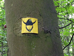
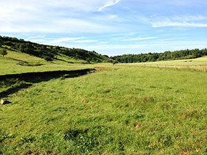
2 - Continue along the Drift, an ancient highway that follows the boundary between Lincolnshire and Leicestershire, also forms part of a Site of Special Scientific Interest (SSSI). With care pass across Saltby Airfield and return to The Drift until a water tower is reached on the right.
3 - Cross over the road and take the left footpath sign into the field keeping the boundary fence on the right. Turn right at the corner of the woods. Follow this to the next woods and turn left into them following a track down and across the next track and the footpath ahead into the fields.
4 - Cross over the road through the first field and then left through the hedge into the field (not marked) and turn right and follow the boundary line around the field. At the end go through the hedge (not marked) into the next field to the bottom left hand corner into the next and half way through left into and across the field to Water Lane (the path was obstructed here, I travelled down through locked gates to the lane at the bottom)- turn right to go past Woolsthorpe manor (Birth place of Sir Isaac Newton). Travel across the road passing the playing field on the left. Walk along the path into the housing estate and out at the end turning left and right to reach a lane. Then turn left and right following the footpath to Spring Lane.
5 - Cross the road and directly across the A1 (be very careful to cross here, alternative is to go over the flyover / bridge) to the path opposite. Eventually this will become Colsterworth Lane. Turn right at the railway bridge and follow the path through fields to reach the A151. Cross the road and continue through fields to Swayfield village. Turn right at the road in the village and next left, then right and left again and continue ahead along Castle Bytham Road.
 6 - Turn left down Water Lane and follow the footpath underneath the railway line to reach The Drift again. Turn right, and then soon left down Gorse Hill. Cross the stream and left to follow the path heading towards the cutting in the hillside and the right top corner of the field. Cross the stile and turn right to follow the hedge boundary to reach a track.
 7 - Turn left to Swinstead. Turn right at the main road to enter the
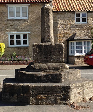
village. Walk past the cross and the pub, turn right on Park Road and follow the road round passing Swinstead Hall on the right, heading towards Ancaster Farm. Turn left to cross the field diagonally and then right along the track to travel through Crow Wood and at the end of it turn right down to the lake.
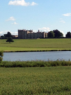 8 - After crossing the ford In Grimsthorpe Park, turn right down the road to walk past the Vaudey on your right ( the Vaudey is an embankment that leads up to the Abbey ). Vaudey Abbey is on the right hand side, but unfortunately there are no visible remains to be seen.
