
|
Distance |
25.5km / 16 miles |
|||
|
IGN map |
GR Top100 Map - 129 Dijon Montbard |
|||
|
Time |
6.5 - 7 hours average time based on Naismith’s rule |
|||
| Total ascent | 426m | |||
| Total descent | 363m | |||
|
Waypoint coordinates |
|
|||
| Download PDF |
|
|
||
|
Overview |
This is another long section, passing along the old Roman road and then head onto woodland tracks which can be muddy. It follows Sigerics original route to reach Marac and then along the D102 to Beauchemin. Sigerics path continues on a very busy road so we leave it here and take a more direct route to the Reservoir de la Mouche before a climb to Langres |
1 - From Rue de l’Abbaye pass the abbey building on your right. At the T-junction turn right D102 direction Bugniers and then as the road goes left follow direction Bugniers passing the 9t sign. Cross over the road D154 and continue on the track to the woods. Cross the electric fence on the left and take the right path of the two into the woods. Then at the broad track turn left to continue past a shooting house / caravan on the left. Continue to a tarmac road and then turn left D102 to Marac. At the junction with the Mairie on the right turn left to continue through the village on the Langres D102 road to the main road D3, Sigeric’s way.
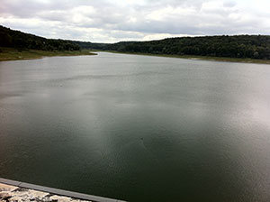 2 - At the main road turn left on the D3 direction Langres. In Beauchemin turn right on the C5 to enter the village of St Ciergues. In that village take the D286 direction La Mouche and then turn right on Rue du Lac. Before reaching the Auberge au Lac turn left down the track to reach the barrage, direction / signed Circuit du Val de Mouche. Cross over the barrage and at the end turn right on the path. This eventually bears right at the barrier and at the T-junction turn left across the road and up the hill.
3 - At the top of the hill turn right and then left (GR marked) just before the church on the right. The path continues up to bear left passing the front of a house to then turn right (again GR marked) to pass the back of the house on the right. At the end then turn left up the hill and at the T-junction turn right and then straight across at the road.
4 - At the next junction / crossroad turn left, GR marked on right tree. After about 2km reach a T-junction, turn right (GR 7 Vieux Moulins) and then the next left, GR 7 Vieux Moulins / Langres 2km.
 5 - Where the track bears left go right downhill (GR on a tree) and then right to reach a road - Buzon Road. Where the road goes left, pass the church on the right along Rue Chanoine Roussel. Take the next right Chemin du Murot and at the end of the road continue on the grass track. Turn left and pass under the railway, then right signed Langres 1.1km. At the road turn left and then left again. This becomes a gravel, grass and tarmac track. At the T-junction turn right and up the path, direction ahead Chemin Gerard Gueniot.
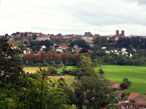
6 - Turn left and left onto the main road. Cross over the road at the crossing, turn right then left through the gateway Porte Neuve. Cross the square on the right and ahead along Rue Jean Roussat to reach Place Diderot at the centre of Langres.
