
|
Distance |
20.9km / 13 miles |
|
|
Explorer maps |
York - OL290, Ripon & Boroughbridge - OL299, Malton - OL300 |
|
|
Time |
5 - 5.5 hours average time based on Naismith’s rule |
|
| Total ascent | 507 | |
|
Total descent
|
458m
|
|
|
Waypoint coordinates |
|
|
| Download PDF |
|
|
|
Overview |
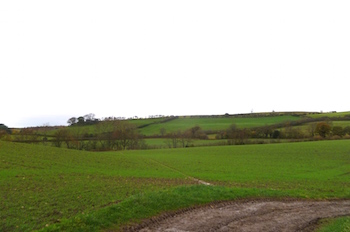
This path leaves the medieval village of Crayke where St Cuthbert is said to have had a Monastery but there are no visible references or indications where this may have been. Continue along the Foss Walk to steadily climbing out of the Vale of York and into the Howardian Hills an Area of Outstanding National Beauty.
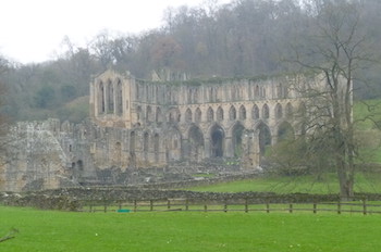
Pass Wass Grange, where the Cistercian Monks from Byland Abbey stored their grain, before reaching Byland Abbey (1147c). After a brief visit or a hot drink at Byland Abbey reach the village of Wass. There is a steep walk up Wass Bank Road before passing Stanbrook Abbey, home to Benedictine Nuns (2009c) where it is possible to either visit or seek accommodation. Finally cross Scawton Moor to reach Rievaulx Abbey and the end of this stage. |
1 - Pass the pub on the right and along Brandsby Street this becomes Brandsby Road to leave the village of Crayke. At the farm shop on the right, the Dutch House, turn left opposite that and continue along the tarmac
lane. Bear right to pass a large white house on the left to reach Woodfield farm at the end of the lane.
2 - Pass the grass island with it on the left and continue straight ahead to pass through a hedge and a stile. Cross the stile and continue ahead to Beckfield House. Pass it on the right to reach a stile and a farm track. Continue straight across the farm track and bear left in the field to Oulstone Road.
4 - Cross the track and the stile ahead and turn right - direction Yearsley. Continue across the fields and through the wood to reach the road. Turn right up the hill and just before the top, take the next footpath left through a field and the farmyard ahead. Cross two stiles heading towards the woods and bear left down the hill to pass woods on the right and then the field boundary. Pass through two gates to Lions Lodge Farm. Continue through the farmyard to the small tarmac Road (Colley Broach Road) and turn left.
After going through a metal gate turn right,signposted Byland Abbey.
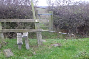
5 - Walk through Old Pilfit farmyard and continue along the track with a wood on the right. At the end of the track turn left into the field (signed Byland Abbey) keeping to the left of the hedge on the right. About half way up the field turn left to a gate and stile. After crossing them bear right down the field to the gate and turn left after going through it and head to Wass Grange.
6 - In the field with Wass Grange on the right, follow the line of the telegraph wires to the left corner of the field passing round a hill on the right and into the next field. Keep to the left side and shortly cross through the hedge into the next one. Cross diagonally right to another stile in a field hedge. After crossing keep the fence on the right to the corner and with
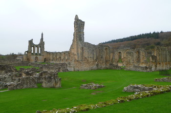
a stone building ruin on the left, turn right and passthrough two gates. After the second turn left towards Byland Abbey now visible ahead. At the Abbey fence turn right to the road. (There is the option here to visit Byland Abbey and / or the tea room across the road from it)
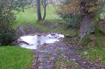
7 - Cross over the road and briefly into the driveway to then turn right across the field and then bear diagonally left up the hill to the far left, this field can be very wet and boggy. After passing over the stile continue diagonally left to Hambleton lane. Turn right into the village of Wass. At the crossroad, with the pub ahead, turn left up Wass Bank road passing Stanbrook Abbey (Working Benedictine Abbey) Crieff Lodges on the left. Take the second footpath left and then keep right. Where the forest track turn left keep ahead into the wood (blue FP sign), this track can be very wet and boggy due to forest vehicles and horse traffic.
8 - At the path four way crossing, continue ahead to arrive at the A170 (High Street). Turn right and then left to pass betweenagricultural buildings. Continue into the field keeping to the right and then towards the island of
trees passing to the left of them, Claythwaite Gill Slack. Continue ahead towards the telegraph pole (Claythwaite Rigg) and then keep left to the field boundary fence and the wood on the left. At the end pass through a metal gate and keep ahead through the wood, downhill on the track to a T-junction
9 - Turn left and follow the track down to the road. Turn right and after passing over the old bridge turn left to reach Rievaulx Abbey ahead on the right.
