|
Distance |
20.7km / 12.8 miles |
|||
|
Explorer maps |
North York Moors, Western Area OL26 & Ripon & Boroughbridge 299 |
|||
|
Time |
4.5 - 5 hours average time based on Naismith’s rule |
|||
| Total ascent | 73m | |||
| Total descent | 138m | |||
|
Waypoint coordinates |
|
|||
| Download PDF |
|
|
||
|
Overview |
This is predominantly a flat walk along a combination of good paths, disused railways, and country roads. |
|||
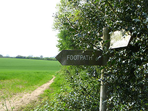 1 - From Byland Abbey follow the road to Coxwold. Shortly after the bends in the road and the house on the right take the footpath sign into the field. Follow the signs to Cam Head and Oldstead Grange. At Cam Head take the left footpath ignoring the Oldstead Grange sign and head into the woods keeping the fence on the left.
Walk over the small bridge and through a gate and into a field. Halfway through the field turn left over two stiles and follow the signs to Coxwold. At the third sign go straight through the field ( keeping the small copse on the left ) to the road and turn left towards Coxwold.
2 - Just before Shandy Hall turn right through fields which lead to a disused railway line.
Turn right onto this, and follow to Elphin Bridge. At Elphin Bridge turn left and just before the small bridge over the stream turn right into a field and left following the field boundary.
Cross over the style, and walk past Baxby Mill to Ings Lane, ignoring the path over the stream on the left.
3 - At Ings Lane turn left, go over the bridge and then right, sign posted Thormanby. Eventually pass underneath a large pylon and into the next field. Ignore the footpath signs ( farmer obstructed the paths at the time of writing the walk) but continue with the stream on right. At the point where a bridge crosses the stream on the right, turn left up the track which becomes Church Lane to arrive at the main road (A19) .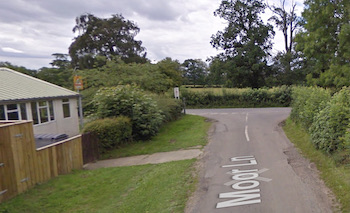
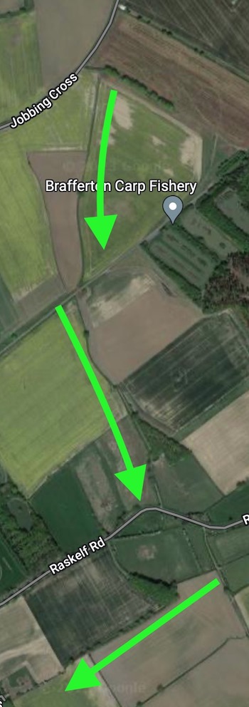
4 - Turn left and then immediately right, carefully crossing the A19 and continue along Moor Lane for approximately 2 miles to arrive at a T-junction. Turn left into the small village of Sessay and Church Lane. After 1.3 miles cross over a railway line to continue ahead on the road now called Jobbing Cross. Pass a house at a junction on the right and then two triangular road signs the opposite way round on the right also. After approximately 100m after the road signs, turn left into a field (Not signposted) and then immediately right to cross diagonally between two fields and across the disused railway line to reach a road.
5 - Turn left and then right and right to reach Back Lane in Brafferton. Turn right to reach Raskelf Road and then left to arrive atThe Oak Tree Inn and possible accommodation for the evening.