
|
Distance |
31.9km / 19.8 miles |
|||
|
IGN map |
GR Top100 Map - 136 Dijon Chalon-sur-Saône |
|||
|
Time |
8 - 8.5 hours average time based on Naismith’s rule |
|||
| Total ascent | 356m | |||
| Total descent | 348m | |||
|
Waypoint coordinates |
|
|||
| Download PDF |
|
|
||
|
Overview |
This stage follows the GRP Chateaux et villages de Haute Saône passing through woodlands, on minor roads and farmland tracks. The route is very undulating but easy to follow. There is a Boulangerie before leaving Gray and a cafe may be seen open for drinks before the end of the stage. |
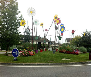 1 - From the Tourist Information office in Gray pass through the carpark to the main road, and turn left to head out of town. Continue straight ahead at the roundabout, Rond Pont des Iles, to pass a petrol garage on the right ( D67 ). Continue straight ahead at the next roundabout, Rond Pont Sainte Anne - direction D67 Bessancon. At the 3rd roundabout turn right direction Dole, Centre Ville.
2 - Pass the cemetery on the left, and take the next left signed Dole (Rue Edmond Drouot). At the small roundabout turn left D21 direction Noiron. After 2.5km past the 2nd crest of a hill and the Maison Forestiere des Chartons house, turn right on the forest track, GR marked. After about 1km turn left on the narrow track, cross over a small ditch, this can be easily missed.
3 - At the path T-junction turn right to cross over a small beck, then bear left and at the next junction turn right, GR sign on left tree. Ignore the track left, and the 2nd on the right, but eventually the path will bear left and at the junction turn right to pass between fields. At the tarmac track continue ahead ignoring the left and right tracks and also the crossroads, but turn left at the T-junction direction Noiron.
4 - Before the church turn right Place des Tilleuls, and bear left and then right to reach the main road. Turn left onto the D475 direction Le Tremblois. Before leaving the village turn left along Rue de Lieucourt (C1 Lieucourt). Ignore the turning to Pesmes, but continue ahead where the road narrows.
 5 - After 2.4km reach the woods and turn right onto the forest track, GR marked on a tree. Carry straight on at the path crossing point and at the t-junction turn right and then left to reach a wider track, GR marked on the right. At the T-junction with a house opposite, turn right and then bear right onto the tarmac road to Vadans.
6 - Just before the church turn right to the Mairie square, and left at the main road, Lavoire opposite and direction D22 Valay-Rue Bassay. Turn right onto the D182 to Chevigney.
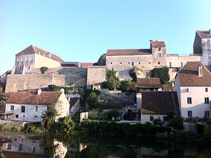
7 - In Chevigney turn left D182 La Resie-St Martin 2.5km. In the village keep the church on your left, pass through Place Marcel Abbey and continue along Rue de l’Eglise. This becomes a track. Skirt round the woods and straight across at the path crossing. Turn left to the D12, then right to Pesmes, then slightly right direction Centre Ville. Go straight on at the next junction and then turn left Rue Choiseut to reach Pesmes Tourist Information and the Mairie.
