
|
Distance |
32.7km / 20.3 miles |
|||
|
IGN map |
GR Top100 Map - 130 Vesoul Langres |
|||
|
Time |
7 - 7.5 hours average time based on Naismith’s rule |
|||
| Total ascent | 414m | |||
| Total descent | 471m | |||
|
Waypoint coordinates |
|
|||
| Download PDF |
|
|
||
|
Overview |
This first part of the route follows minor roads and tracks and there is the opportunity to seek accommodation at Champlitte 11.7km from the start of this stage. After that the stage continues mostly off road following the footpaths of the Sentier de la Vallee du Salon. |
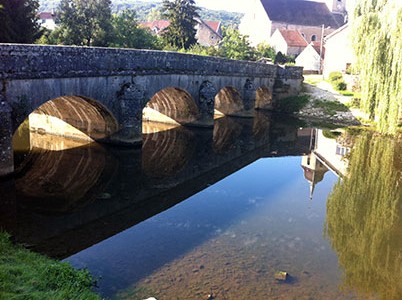 1 - From Place des Halles and the monument continue straight ahead, turn right along Rue de la Barre and left Rue sous les Guerets. Cross the stone bridge and then turn left and left again at the next junction, yellow hand painted VF. Turn right Rue du Pont de Frettes and continue straight ahead between the fields on the grass track. Ignore left and right tracks. At the gravel track continue straight ahead to eventually cross over the river ridge, and at the next t-junction turn right to reach the village of Leffond.
2 - Before the bridge turn left Rue de Verdu ignoring the path right over the river but continue straight ahead past the two crosses on the left. After 3.6km reach a tarmac road and turn right. Cross over the bridge into Monarlot-les-Champlitte. Mairie is a VF and Compostella hostel. Pass through the village on the D222 to Champlitte.
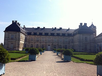 3 - In Champlitte continue along Rue de Montarlot, and turn left at the main road to reach the cen-tre. Pass the Chateau and La Poste on your left, turn left Rue du Bourg passing a fountain and then turn right Rue de la Breche. Ignore the VF left, but continue ahead and then straight on Rue de la Vielle Route. Continue up the hill and take the 2nd track left, VF sign on the left road sign, GR de Pays on the left green post to pass in between stone walls.
4 - At the T-junction turn left, follow the road across the old railway line, then turn right signed Sentier de la Vallee. Follow the track bearing right onto grass (VF painted man symbol on post). Track will bear left then right (GR on right tree), and will pass the railway tunnel on the right. Take the 2nd track left ahead to pass the field on the right. Continue ahead on the tarmac and up the slight hill, Ruelle du Moulin, cross over the road past the Lavoire and along Ruelle de la Fontaine.
5 - At the crossroads turn right up the hill, Grande Rue, and then left Rue de Franois to pass the church and out of the village. At the T-junction turn right, signed Velo Framont then at the junction with the D36 turn right direction Gray, and then turn left to pass the back of house number 5.
6 - Continue on the tarmac road and at the T-junction turn left then bear right. Follow the road left again and before the bridge turn right on to the track and keep left to stay on the main track. At the main road turn left, then right, and at the junction go left to the village of Montot.
7 - Continue across the next junction D171 Denevre - Grande Rue, pass the cemetery on the left, and go straight ahead onto the small road (not left on the main road). Turn left at the T-junction then right at the stone cross, and left at the next junction. At the next T-junction turn right to the crossroads with the D70, turn left. Cross over two river bridges, then turn left to reach the centre of Dampierre and the tourist information on the right.
