
|
Distance |
19.3km / 11.9 miles |
|||
|
IGN map |
GR Top100 Map - 104 Reims Saint - Quentin |
|||
|
Time |
4.5 - 5 hours average time based on Naismith’s rule |
|||
| Total ascent | 3m | |||
| Total descent | 20m | |||
|
Waypoint coordinates |
|
|||
| Download PDF |
|
|||
|
Overview |
The route gives the option of following the ancient track that Sigeric took along the D1044 / A26 for approximately 10km to Berry-au-Bac but it is a busy road so an early start may be wise to avoid a lot of traffic. Continue along minor roads, through vineyards that are very pleasant to walk through, and woodland tracks. It is undulating in sections but generally a fairly easy stage. |
1 - With Corbeny Mairie behind you turn left past the church and then right at the crossroads D1044 / A26 Route de Reims for 10km to Berry-au-Bac (ALTERNATE ROUTE AVAILABLE). This is an extremely busy road and follows the route that Sigiec took.
2 - Continue along the main road through Berry-au-Bac and after crossing over the canal Lateral a l’Aisne, ignore D1140 but take the right turn Rue de Cormicy (VF signed) to Cormicy.
 3 - At the edge of the village take the first left by the
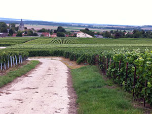
‘Bienvenue a Cormicy' sign and then right to pass the cemetery on the left. Cross over the road and turn right at the church Rue de Puits au Pivot. Before reaching the Champagne Didier Fran-cois turn left along Rue du Bois des Pre, then left between the houses along the concrete track and through the vineyards.
4 - At the path crossing go ahead on the grass track to keep the vines on the left and then continue into the woods. At the crossroads continue ahead and then at the T-junction turn left out of the woods alongside fields.
5 - At the T-junction of the tracks turn left, pass the wooden cross in the trees, then left between fields, and right down the hill. Go straight across the track (GR sign on right tree), down the hill to reach grape vines passing them on your right.  At the end bear right, pass the houses on the left, and continue along the gravel path to arrive at Place du Montcet.
6 - At Hermonville centre turn left to go down Rue de Temple, and right Rue l’Eglise past the church to the Place de la Mairie.