
|
Distance |
17.6 km / 10.9 miles |
|||
|
Explorer maps |
208 Bedford & St Neotts, 192 Buckingham & Milton Keynes |
|||
|
Time |
4 - 4.5 hours average time based on Naismith’s rule |
|||
| Total ascent | 168m | |||
| Total descent | 135m | |||
|
Waypoint coordinates |
|
|||
| Download PDF |
|
|
||
|
Overview |
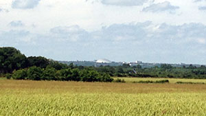
Follow parts of the Milton Keynes Boundary Walk to Aspley Guise, then marked paths to Woburn and the Greensand Ridge Walk to Woburn Abbey. Pass through the medieval villages of Aspley Guise and Woburn. The route is along fairly flat terrain. |
|||
 1 - Start at the end of Shires Lane from the previous stage. Continue down the road and straight across to the bridleway, left past Broughton Grounds around the field boundary and right. Turn right before to the trees to head to Salford wood to reach Broughton Road and Salford
2 - In Salford turn right down Brittens Lane and then right Waveden Road for approximately 1 mile crossing over the motorway. Take road right signed Wavenden (Lower End Road), then the footpath left Wavendon House Drive. Pass in front of Wavendon House and through the golf course passing a bunker on your right to a path junction. Turn left to pass between two greens, turn right at the path junction to cross a green then immediately left to pick up the path (pond behind you) to reach the road at Deeth Farm.
3 - Turn right to Woburn Sands and then footpath left opposite Deethe Close on the right. Walk through the estate to the end. Continue ahead to pass over the railway crossing, into field and then left (Mill Lane) alongside a golf course past Radwell Pit houses. Bear left to cross over the golf fairway, immediately before the second green turn right to pass a group of trees on the right to reach the sports field. Bear left to the track and turn left to Common Farm. At the farm turn right to cross the field diagonally to the road ( Aspley Guise ).
 4 - Turn right to the market shelter, cross the road ahead and up Woburn Lane and then left into Spinney Lane. With the school on your left take the footpath right, then right down Gypsy Lane, and on the road corner left to Birchmoor Farm. Turn left up the farm drive and then right to pass in front of the farm. At the end of the track bear left direction Woburn and Birchmoor Green. Turn left on the main road into Woburn village.
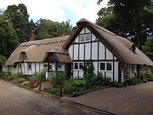
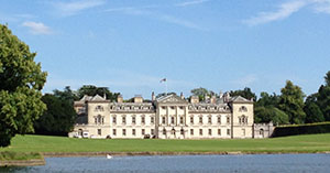 5 - Upon entering Woburn village turn right down Casswell Lane, past the Old Smithy to reach Timber Lane. Turn left and left again onto Leighton Street. At the end of the large block of houses, take the footpath right into the woods and then left to follow Green Sand Ridge Walk. Travel along the pasture, Wayn Close and then turn left back into the woods to arrive at the main road. Turn right and then footpath left into Woburn Abbey Grounds. Follow the signs to Woburn Abbey.
