
|
Distance |
15.3 km / 9.5 miles |
|||
|
Explorer map |
224 Corby, Kettering & Wellingborough |
|||
|
Time |
3.5 - 4 hours average time based on Naismith’s rule |
|||
| Total ascent | 371m | |||
| Total descent | 172m | |||
|
Waypoint coordinates |
|
|||
| Download PDF |
|
|
||
|
Overview |
From Great Easton the route is easy going and continues most of the way on the Jurassic way. Pass through the medieval villages of Bringhurst, Cottingham, East Carlton. |
|||
 1 - In Great Easton head to the monument and walk down Barnsdale road past the Corset Factory. Just before Clarkes Dale Road on the right take footpath left to Brighurst (sign easily missed, to the left of the gate). At the road turn right and at the red telephone box turn left signed Bringhurst only. Continue along the no-through road past the church to the end of the road and the footpath Jurassic Way - bear left to the stile into the next fields and crossing the old railway line to the track.
 2 - Turn left this becomes Occupation Road. Just before the end, after the metal barrier turn left to reach Mill Road. Turn right to Cottingham and right on Mill Road past the school. Turn left at the junction signed Rockingham / Corby, and then right down Church Street. Pass Water Lane on the left and travel up the steps to the church and the footpath immediately right to Middleton, ignoring paths off to the left. In Middleton turn right down the hill and right on the main road. Just past the Red Lion Pub to take the footpath left to East Carlton and then Wilbarston - Jurassic Way.
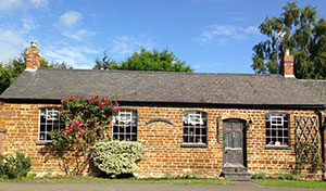
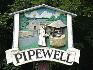
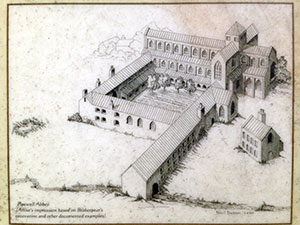 3 - At Wilbarston we leave the Jurassic Way. Turn left after leaving the playing fields onto the B669, and then the bridleway right to the cross field following the boundary round to cross over the A427 through the next fields. Crossing diagonally over three and the fourth to the right boundary line and the minor road. Turn right and where the road bends left turn right to the disused airfield. At the end of the track turn left and follow the old runway round. At the end bear left across the field and into Pipewell wood then left to skirt the left edge of the wood to reach the village of Pipewell . At the road turn right and just after the houses on the left there is an information board regarding Pipewell Abbey.
